Friends of Lakeside Park

1800logo copy

Let’s Wait for the Feasibility Study – Dan Degner

Let's Wait for the Feasibility Study

September 28, 2020

At the March 25, 2020 Fond du Lac City Council meeting, Council member Kay Miller put a discussion item on the agenda asking the council to consider a survey of public opinion on the Alternative Master Plan (AMP).  The AMP was approved by the council in the previous month.   

Council member Dan Degner made three points in his short (under 2 minute comments, you can listen below).  First, any council member could do their own survey.  Second, it would be premature to survey before the feasibility study is done as the information on the projects is missing without the study.  Third, going ahead on a survey without the feasibility is potentially misinforming people.  

Council member Degner also points out that the public has every opportunity to walk along the process and provide feedback.   Over 3,000 citizens have sign a petition asking that they have a say in approving development on the Lighthouse Point Island. 

QUESTIONS for Dan Degner:  If it is important to wait for the feasibility study for a public survey, isn’t it premature to sign a developer’s agreement without the feasibility study results and some time to study what they mean?    What is the rush?

What’s With the Flood Plain?


What's With the Flood Plain?

September 27, 2020

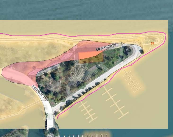
We’ve been told the Restaurant/Mixed Use building has to go on the peninsula as that is the only place where it could be built and not be in the flood plain.  Below is the flood plain map of the park. 

The light yellow orange is the 100 year flood plain.  This shows the most likely areas to flood.  The pink area is the 500 year flood plain.  This also can flood, but it is less likely.  If you look at the pavilion, you can see that some of the pavilion is in the 500 year flood plain.   

Let’s talk about some other locations.  The site for the “hub building” at the end of main street is in flood plain.  Looks like that was a poor choice.   If you go west, over toward the Fond du Lac river, much of that area, Fraizer Point is NOT in the flood plain.  Many people have suggested this location for a structure.  


In a July 7th 2020 interview on Between the Lines with Greg Stensland (minute 5:10), Ben Giles stated that the restaurant building could not go on Fraizer Point because of the 1982 referendum.   THIS IS NOT true.  The 1982 referendum was repealed by the city council probably in 1992 and if not at that time, it was gone by 2014.   

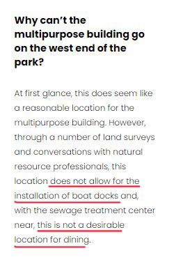
In the FAQ on the Lakeside Forward website it says the Fraizer Point location does not allow for the installation of boat docks and that “Stinky Point” is not desirable for dining.   

Looking at the peninsula map from the Alternative Master Plan, overlayed with the flood plain map,  it looks like the Restaurant/Mixed Use building is going to be placed in the 500 year flood plain.  To be close to the shoreline it goes in the 500 year flood plain. 

Additionally , there is very little room for moving the building to the west without ending up in 100 year flood plain.  You can see that the 100 year flood plain dips inland quickly as you go west.  

Moving it further to the west isn’t an option, as all of that area is in the flood plain.  It made sense to put the restaurant on the second floor of a new multipurpose building on the pavilion site.  That option is no longer possible because of the decision in August 2020 to proceed with the pavilion remodel. 

We were told the restaurant building was moved to the west.  It certainly wasn’t very far to the west and frankly, there isn’t a suitable out of flood plain location on the Lighthouse Point Island.  Practically speaking, the only flood zone free location for a building is on Fraizer Point. 
QUESTION for the Lakeside Park Supporters:  Even though boating is seasonal, is it essential to you that the restaurant building be near boat docks where large boats can come in?

It Looks Like a Sidewalk


It Looks Like a Sidewalk

September 27, 2020

Recommendation #2 in the  Lakeside Park Exploratory Committee (LPEC) is a Boardwalk.  It states:

There have been lots of questions about how this would be done.  Where would the boardwalks go and what would they cost?  What will happen to the existing rocks?  What about ice shoves?  We have never had really clear answers about the boardwalks.  In the images of the Lighthouse peninsula in the Alternative Master Plan (AMP), they look like sidewalks.  

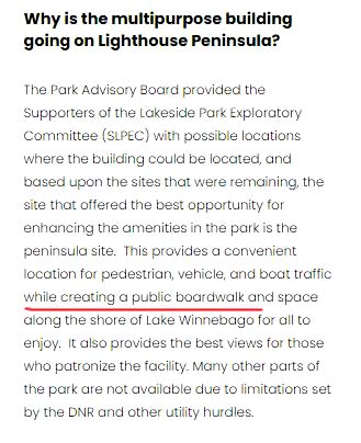
In the FAQ on the Lakeside Forward website it says there will be a public boardwalk along the shore of Lake Winnebago for all to enjoy.  

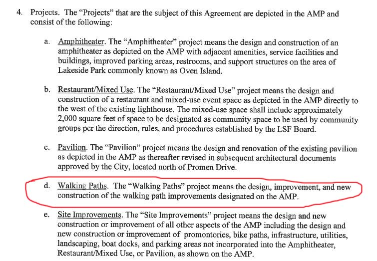
We might have some answers in the Lakeside Park Enhancement Agreement that was presented by the Investor group at the September 23, 2020 City Council Meeting.  In Section 4 which lists the projects that are part of the agreement, item d says Walking Paths.  The “Walking Paths” project means the design, improvement, and new construction of the walking path improvements designated on the AMP.  

QUESTION for the Lakeside Park Supporters:  Where are the boardwalks?